The GeologyOntario (includes OGSEarth) web pages will be updated with a new look in the coming weeks, starting at the end of September 2021.
The updated design improves the user experience by simplifying the layout, making the pages more mobile compatible, and aligning with other Ministry web pages.
Please contact Alphons Evers (alphons.evers@ontario.ca) if you encounter any issues after the change or have any questions.
During this update, this page will be removed. Please update your bookmark to the following: Elevation.
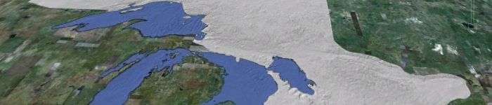
Elevation contains elevation data acquired from Nasa through the Shuttle Radar Topography Mission.
Data includes: shaded relief and elevation models displaying terrain elevation across the province of Ontario.