The GeologyOntario (includes OGSEarth) web pages will be updated with a new look in the coming weeks, starting at the end of September 2021.
The updated design improves the user experience by simplifying the layout, making the pages more mobile compatible, and aligning with other Ministry web pages.
Please contact Alphons Evers (alphons.evers@ontario.ca) if you encounter any issues after the change or have any questions.
During this update, this page will be removed. Please update your bookmark to the following: Geophysical.
(updated October 1, 2021)
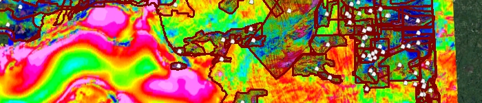
The Geophysics kml contains polygons and images illustrating areas that have published digital data products released by the Ontario Geological Survey.
Data includes: images of high resolution aeromagnetic surveys (residual magnetic intensity and second vertical derivative), regional gravity (bouguer and first vertical derivative), regional magnetics (residual magnetic intensity and first vertical derivative), locations of published airborne surveys, seismic and magnetotelluric data with links to download the data from GeologyOntario.
Download the Geophysical Survey Index in GIS format.